Expert Surveying Services on the Cassowary Coast and Beyond
Our Surveying Services
TerraModus Surveying delivers reliable, high-quality professional land surveying solutions suited to various needs. Catering to the Cassowary Coast, we specialise in cadastral and engineering surveys, offering services such as boundary identification, subdivisions, leases and detailed site mapping. “TerraModus” translates to “earth measurement,” reflecting our dedication to providing precise, harmonious survey data for every project.
We work closely with developers, homeowners, councils, government and local businesses to offer accurate information for planning and property management. Whether it’s defining boundaries, facilitating property development, or supporting complex projects, TerraModus Surveying is here to ensure your projects proceed confidently.
For a dependable surveyor on the Cassowary Coast, please complete our enquiry form to discuss your project and connect with a committed team.
What We Do

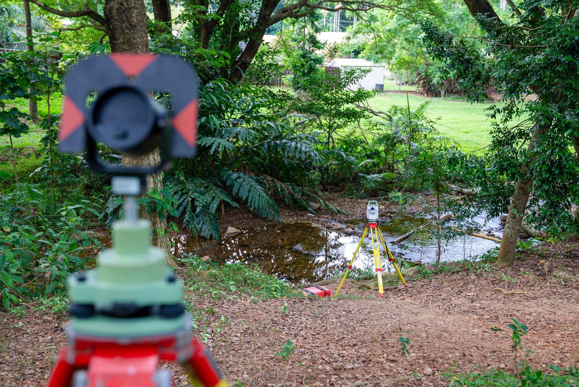
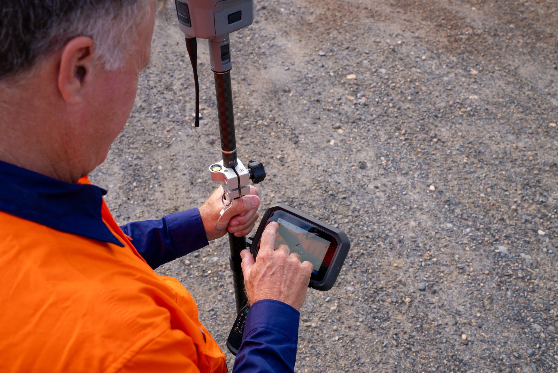
We perform cadastral surveys on the Cassowary Coast, providing clear boundary identification, easement and lease surveys, and surveying services for boundary realignments. Our detailed land measurements support everything from small property developments to complex boundary adjustments, ensuring compliance with local councils and the Queensland surveying legislation. We provide the accuracy and reliability of land boundaries you are looking for.
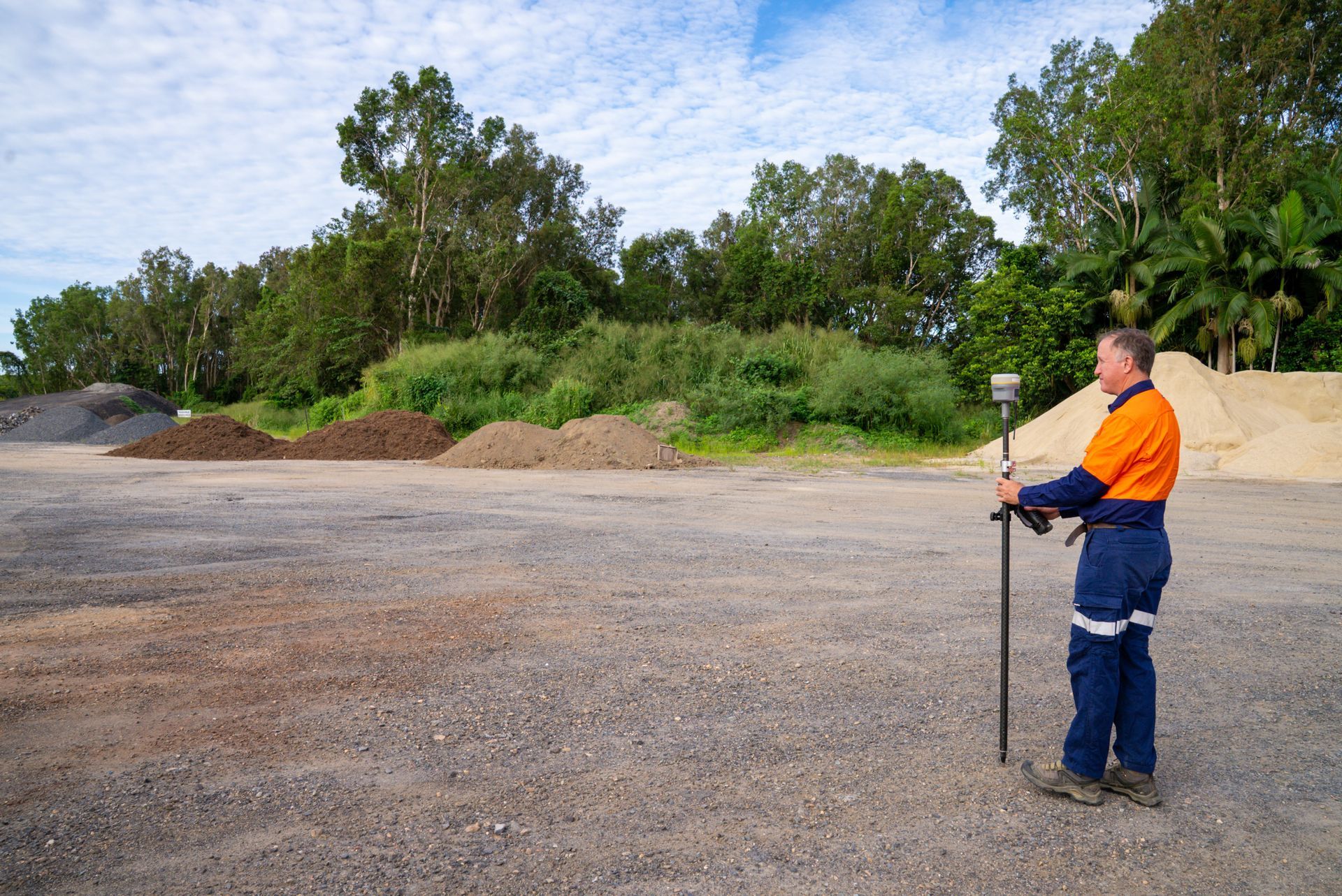
Our engineering surveys supply essential data for effective development, construction and design across the Cassowary Coast. With services like contour mapping, feature location, AHD level surveys, and as-constructed surveys, we provide accurate insights to support project planning, building and infrastructure development. We provide the accurate detailed data driven solutions you require.
Why Choose Us?
Choose TerraModus Surveying for accuracy, reliability, and a personalised approach to all surveying needs. As a family-owned business, we take pride in delivering quality service, making us the go-to choice for the Cassowary Coast. Here’s what makes us stand out:
- Our registered qualified surveyors bring strong local expertise to each project.
- Comprehensive cadastral and engineering surveys that are customised to meet your needs.
- Our field surveys are undertaken by registered surveyors, not graduates or technicians, ensuring accurate, clear and trustworthy survey data.
- Certified information you can trust including Form 12 certifications.
- Exceptional plans produced to the highest professional standards.
- Professional, friendly support tailored to each project’s unique requirements.
- Superior quality assurance meaning no delays or requisitions with council or titling.
For a trusted surveyor on the Cassowary Coast, call TerraModus Surveying on (07) 4054 4072. Let us provide the accurate data you need for every surveying requirement.
Enquire Now In Cassowary Coast
* Please complete all fields of the form. As each survey is unique, we require the location of your survey to respond appropriately to your enquiry. If you have multiple attachments, please email us separately.
Contact Us
T. 07 4054 4072
M. 0413 580 146
Trading Hours
- Monday
- -
- Tuesday
- -
- Wednesday
- -
- Thursday
- -
- Friday
- -
- Saturday
- Appointment Only
- Sunday
- Appointment Only


Frequently Asked Questions
What areas do you service?
TerraModus Surveying provides a wide range of surveying services for the Cassowary Coast and the surrounding areas, including Innisfail, Tully, Silkwood and Mission Beach. We service all urban and rural areas of the Cassowary Coast.
When is an engineering survey needed?
Engineering surveys are required in various construction and design projects to provide accurate site data. They’re commonly needed for land developments, road construction, building projects, and infrastructure works, offering essential details about terrain, elevation, and existing structures. Before construction begins, engineers and architects use survey information to design buildings, foundations, drainage systems, and other site-specific elements. Engineering surveys are also valuable during construction to ensure projects align with design plans. After construction, as-constructed surveys verify that the completed work meets regulatory and design standards, preventing future issues with project compliance.
How does an engineering survey assist in construction projects?
Engineering surveys provide precise data that is critical in the planning and construction stages of a project. They identify the land’s topography, slope, elevation, and existing features, which helps architects and engineers design structures suited to the site. For example, contour and detail surveys ensure that the land is appropriately prepared for foundations and drainage, reducing the risk of structural issues. During construction, engineers rely on control surveys to maintain accurate positioning of structures. After completion, as-constructed surveys confirm that everything aligns with the design plans, ensuring project integrity.
What is a contour and detail survey?
A contour and detail survey maps the land’s surface, showing elevation changes, natural features, and man-made structures. This type of survey is essential for design and construction projects, providing a detailed representation of the site’s characteristics. The data gathered helps architects, engineers, and builders understand the site’s layout, plan drainage systems, and design structures suited to the land’s contours. Using technologies like GNSS and total stations, surveyors create accurate maps that show elevation lines (contours) and detailed information about the land, improving the accuracy of construction and site preparation.
How does a cadastral survey differ from a topographic survey?
While both cadastral and topographic surveys measure land, they serve different purposes. A cadastral survey focuses on legally defining property boundaries and easements, which is crucial for property ownership and land subdivision. In contrast, a topographic survey maps natural and man-made features on the land, including elevation changes, vegetation, buildings, and utilities. This data aids in planning, construction, and design work. Cadastral surveys are legally binding, often required for land transactions, whereas topographic surveys (also known as contour and detail surveys) are primarily used for design and engineering projects. Legally cadastral surveys must be performed by Registered Cadastral Surveyors as the titling system underpins all development in Queensland and therefore it is important appropriately qualified people undertake these surveys. Cadastral Surveyors are appropriately trained and qualified to perform all types of surveys including cadastral and topographic surveys.