Experienced Engineering Surveyor in Cairns
Our Engineering Surveys
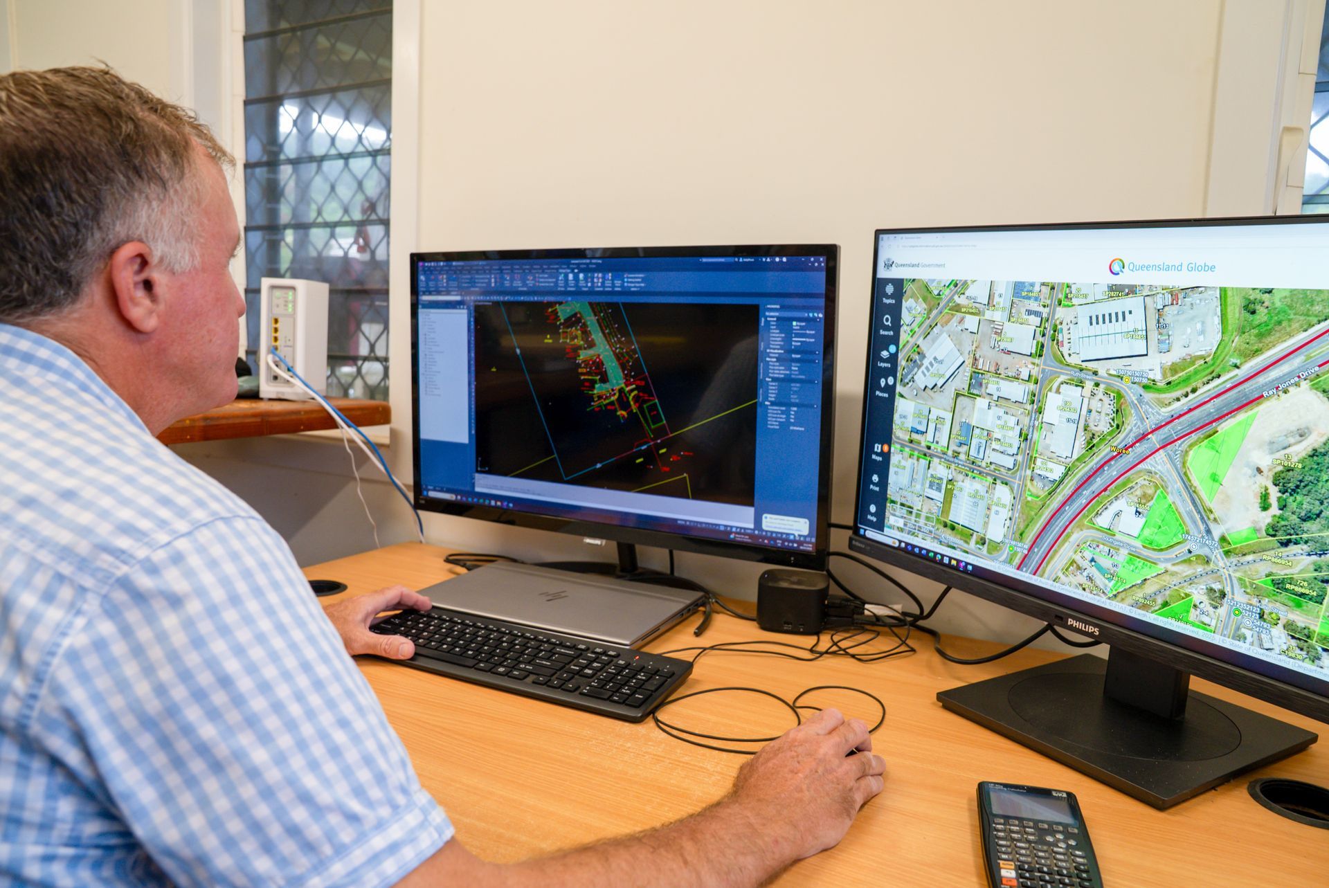
TerraModus Surveying offers a complete suite of engineering surveys across the Cairns region and Far North Queensland, meeting the diverse needs of projects in urban, rural, and remote areas.
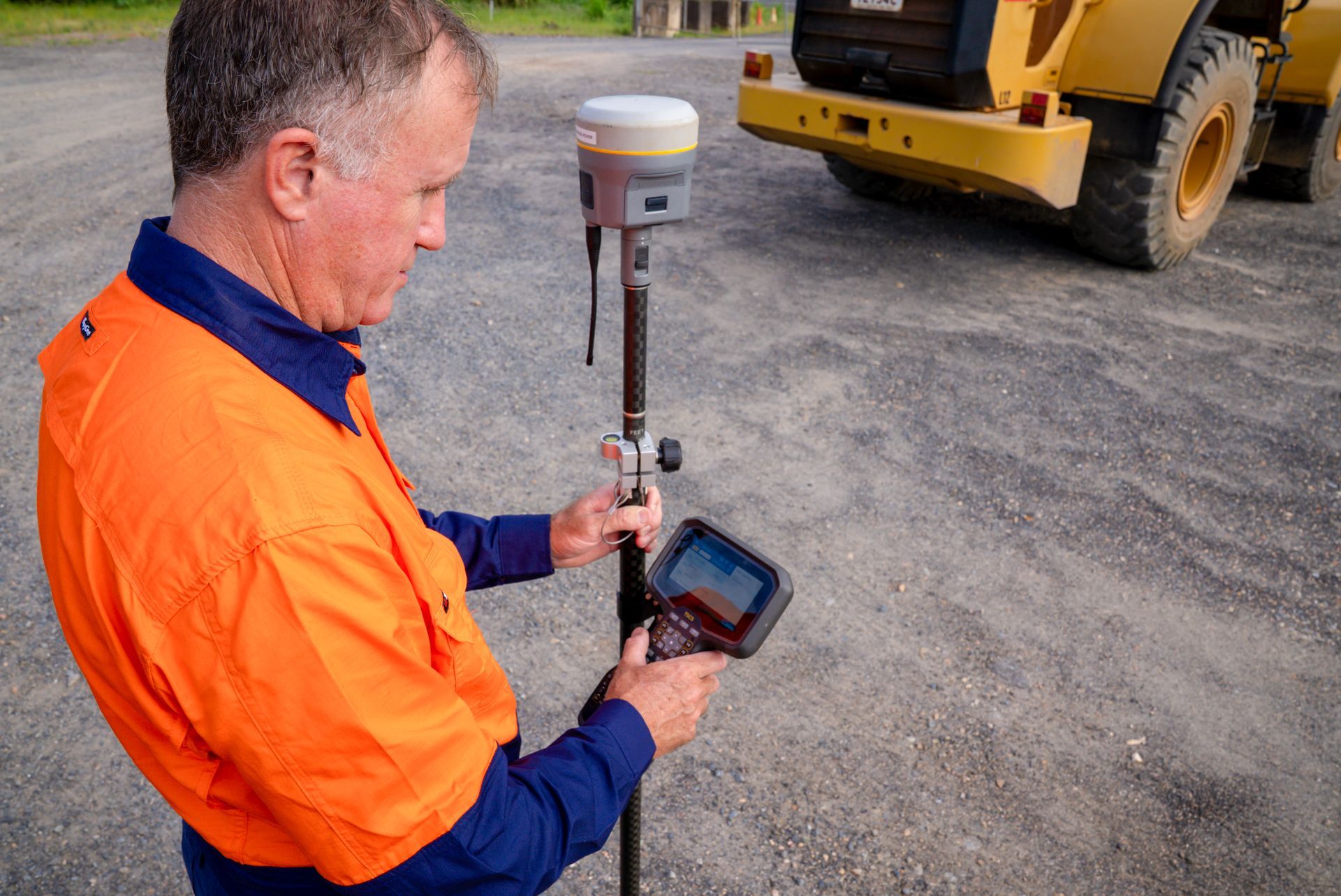
As an experienced registered engineering surveyor in Cairns, our services include topographic surveys also known as contour and detail surveys, AHD level surveys, as-constructed surveys, asset location, and monitoring surveys. We also perform control surveys and GNSS (Global Navigation Satellite Systems) surveys. These services deliver essential, accurate data on topography, elevation, and site features, supporting construction planning and regulatory compliance. We can supply Form 12 certifications for all these surveys, including a level above AHD, to ensure the build is above the council flood height information.
For reliable engineering surveying in Cairns, the Atherton Tablelands, the Cassowary Coast, the Douglas Shire, Cape York, and beyond, please complete our enquiry form to discuss your project’s needs.
Reliable Surveys, Trusted Results
Why Choose Us?
At TerraModus Surveying, we bring expertise and precision to every engineering survey. Here’s what makes us a trusted choice:
- Qualified Expertise: Registered Engineering surveyors with extensive local knowledge.
- Diverse Services: From contour mapping to AHD level checks, for projects of all scales.
- High Accuracy: Advanced technology ensures precise measurements for planning and compliance.
- 30 Years of Experience: Experience makes all the difference when precision and efficiency matter.
- Superior Products: Surveys are prepared to the highest standards, containing complete data in the required layers for seamless integration.
- Regulatory Compliance: Surveys adhere to Queensland’s requirements, promoting quality and safety.
- Extensive Reach: Serving Cairns, the Atherton Tablelands, the Cassowary Coast, the Douglas Shire, and Cape York.
If you're looking for a trusted engineering surveyor in Cairns, call TerraModus Surveying on (07) 4054 4072 or complete our enquiry form. Let us provide essential data for your project’s success.
Frequently Asked Questions
What is an engineering survey?
An engineering survey provides essential data on land contours, elevations, and features for use in construction, planning, and design. This type of survey includes topographic surveys, contour and detail mapping, height assessments, and site measurements. Engineering surveys assist architects, designers, engineers, and builders in understanding the land’s characteristics, ensuring projects are designed with site-specific data. This information is critical in construction planning for everything from where services are to be located, how much cut and fill is required, building above flood levels, and abiding by council requirements.
These surveys can involve using various technologies, such as total station, GNSS and Lidar data, for precise measurements over large areas. The data collected helps prevent construction issues and ensures that structures are built accurately and safely according to the unique conditions of each site.
What is an AHD level survey?
An Australian Height Datum (AHD) level survey measures the height of land relative to mean sea level. This survey is used to assess flood risks and therefore is considered essential in construction near flood-prone areas. Surveyors transfer height data from known AHD benchmarks to the site, helping builders and designers determine safe elevation for structures.
Councils may require AHD level survey certification for developments in areas susceptible to flooding. By ensuring that construction occurs above specific flood levels, AHD surveys help safeguard properties from potential water damage, promoting safety and compliance with local building codes.
What is an as-constructed survey?
An as-constructed survey verifies that a completed structure matches the approved design specifications. Often performed at the end of construction, it records the exact location of built features, like roads, drainage systems, or buildings. This survey is essential for quality control, providing documentation that all components align with initial plans and regulatory standards.
Councils may require as-constructed surveys for infrastructure projects to confirm compliance. By ensuring construction accuracy, these surveys help detect any deviations, which can then be corrected before final project approval, promoting the integrity of completed projects.