Expert Surveying Services in Cairns and Beyond
About Our Services
TerraModus Surveying offers dependable, expert land surveying services that cover a wide range of needs. Based in Cairns, we specialise in cadastral and engineering surveys, including boundary identification, subdivisions, and detailed site mapping. “TerraModus” means “earth measurement,” and it reflects our commitment to delivering precise, high-quality survey data for every project, no matter the complexity or locality.
We collaborate closely with developers, homeowners, councils, government and local businesses to provide accurate, thorough information for planning and property management. Whether it’s locating property boundaries, supporting developments, or navigating complex projects that require valuable survey information, TerraModus Surveying is here to help clients move forward confidently.
Looking for a reliable surveyor in Cairns? Please send us an enquiry online to discuss your project and get guidance from a team that genuinely cares about delivering the best results.
What We Do
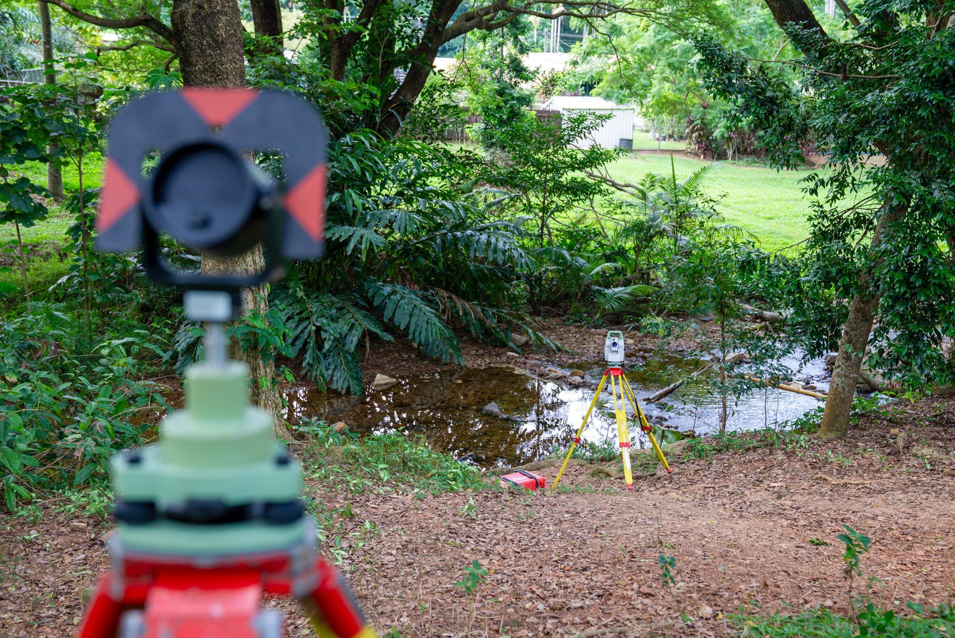
Our cadastral surveys in Cairns accurately define property boundaries, subdivisions, easements and leases. We take pride in all our work from the field survey to the preparation of the survey plans ensuring you receive the best results. Whether for residential or commercial properties, we deliver reliable land measurements that support property development, boundary realignments, and compliance with the Queensland land and surveying regulations. We provide the accuracy and certainty of property boundaries you are looking for.
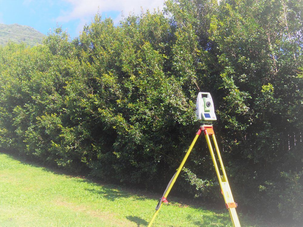
We provide engineering surveys throughout Cairns, offering essential data for construction and design projects. Our services include contour and detail surveys, AHD level surveys, and as-constructed surveys, delivering the precision needed for accurate planning and project compliance. With attentive collection of survey information and carefully attributed data that will seamlessly integrate with engineers, architects, designers and councils you are assured of data excellence to support your project.
Why Choose Us?
Choose TerraModus Surveying for accuracy, reliability, and a client-focused approach to all your surveying needs. As a family-owned business, we’re committed to delivering high-quality service with a personal touch, making us the trusted choice for Cairns and the surrounding areas. Here’s what sets us apart:
- Our team of experienced, registered surveyors brings deep local knowledge to every project.
- All our field work is performed by registered cadastral and engineering surveyors, not technicians or associates, ensuring proficient and reliable surveys on the ground at the time
- We offer comprehensive cadastral and engineering surveys, tailored to a variety of needs.
- You will receive clear, precise and certified data
- We provide friendly, professional support that’s responsive to each project’s unique requirements.
- With solutions for projects of any size, we are here to help every step of the way.
- Certified plans ensuring your project meets all the building and council requirements, including the issue of Form 12 certification.
- Superior quality assurance, meaning no delays or requisitions with council or titling.
For a trusted surveyor in Cairns, call TerraModus Surveying on (07) 4054 4072. Let us support your next project with accurate, reliable data, tailored to meet every surveying need.

Enquire Now In Cairns
* Please complete all fields of the form. As each survey is unique, we require the location of your survey to respond appropriately to your enquiry. If you have multiple attachments, please email us separately.
Contact Us
T. 07 4054 4072
M. 0413 580 146
Trading Hours
- Monday
- -
- Tuesday
- -
- Wednesday
- -
- Thursday
- -
- Friday
- -
- Saturday
- Appointment Only
- Sunday
- Appointment Only


Frequently Asked Questions
What areas do you service?
TerraModus Surveying provides a wide range of surveying services throughout Cairns and the surrounding areas, including Cairns City, the northern beaches, Gordonvale, Babinda, Smithfield and Kuranda. We service all suburbs of Cairns.
What is a cadastral survey?
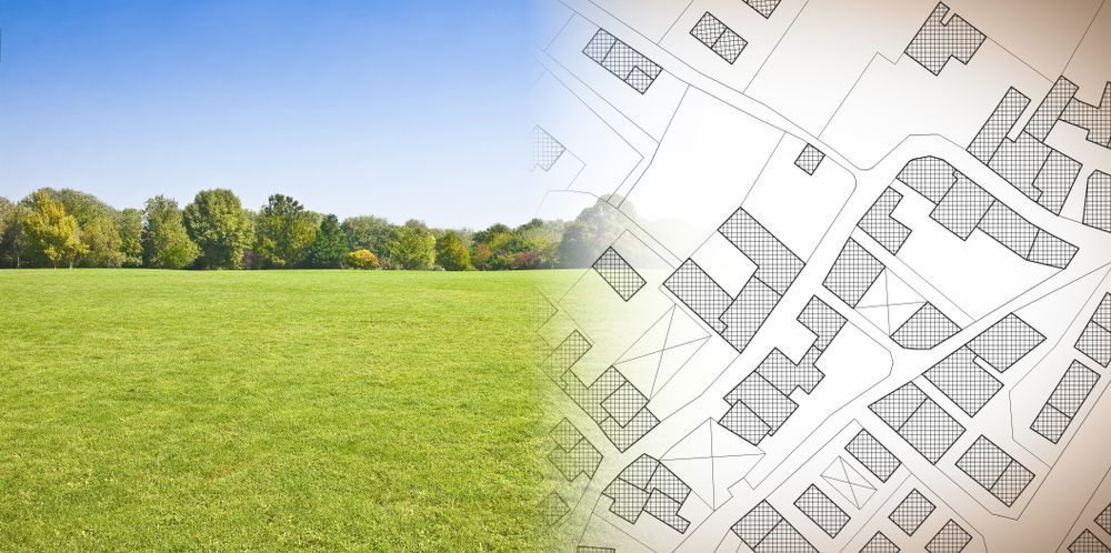
A cadastral survey is a land survey that defines the legal boundaries of a property. It establishes boundary lines, identifies easements, and determines the dimensions of land parcels. Cadastral surveys are often used for property sales, development, subdivisions, and legal documentation of land ownership. These surveys are conducted by registered cadastral surveyors, who follow strict standards to ensure compliance with local regulations. The survey’s result is an official plan that marks property boundaries accurately, helping landowners avoid disputes and confidently plan for property improvements, constructions, or future land transactions.
How does a cadastral survey differ from a topographic survey?
While both cadastral and topographic surveys measure land, they serve different purposes. A cadastral survey focuses on legally defining property boundaries and easements, which is crucial for property ownership and land division. In contrast, a topographic survey maps natural and man-made features on the land, including elevation changes, vegetation, buildings, and utilities. This data aids in planning, construction, and design work. Cadastral surveys are legally binding, often required for land transactions, whereas topographic surveys are primarily used for design and engineering projects.
Can cadastral surveys resolve boundary disputes?
Yes, cadastral surveys are often used to resolve disputes over land boundaries and fences. By accurately establishing property lines, cadastral surveys clarify where one property ends, and another begins, and can locate all infrastructure near boundaries helping to settle disagreements with neighbours. In cases of encroachments or unclear boundaries, a cadastral survey provides legally recognised evidence of the existing property dimensions and boundaries. The resulting survey plan serves as official documentation of the boundary location and is confirmation that the survey has been performed in accordance with all legislation and requirements, and the surveyor is appropriately registered and insured, protecting you and your property.
TerraModus Surveying can perform cadastral surveys and can provide authoritative expert evidence on all land boundary matters.
What are the common types of engineering surveys?
An engineering survey provides essential data on land contours, elevations, and features for use in construction, planning, and design. This type of survey includes topographic surveys, contour and detail mapping, AHD heights, and site-specific measurements. Engineering surveys include several types, each serving unique project needs. Contour and detail surveys map the land’s elevation and features, aiding in site design. AHD level surveys provide height data for a site which can ensure buildings are designed and built above known flood levels. Each survey type contributes essential data, helping design, construction, and planning teams create structures aligned with local topography and regulatory requirements.