Reliable Cadastral Surveyor in Cairns

Our Cadastral Surveys
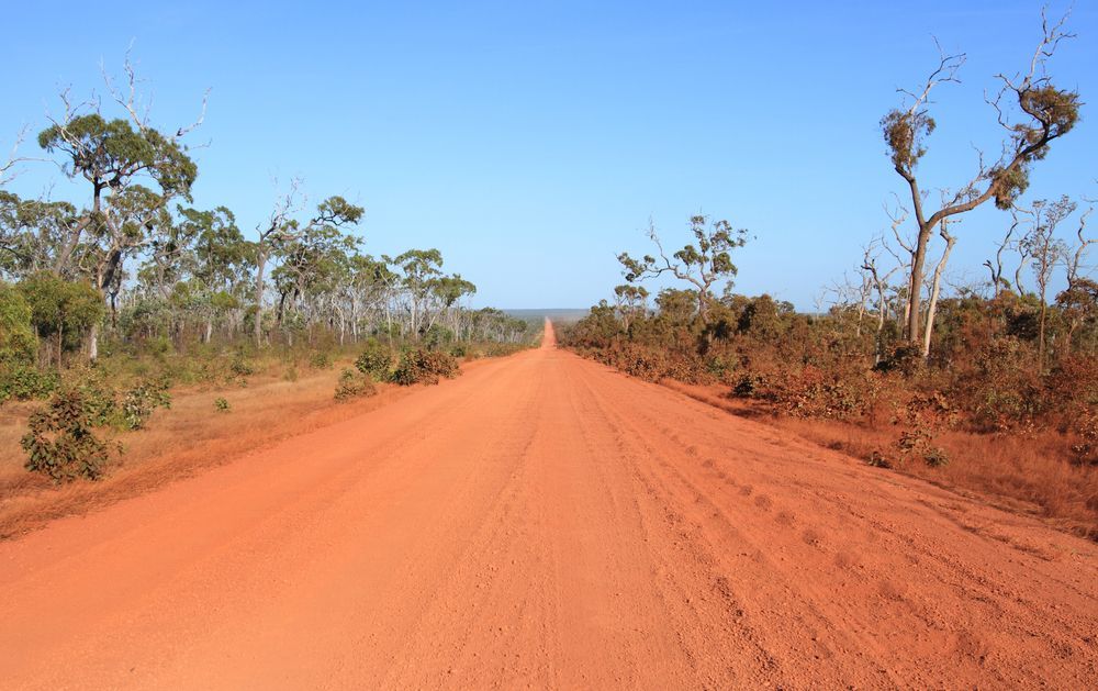
TerraModus Surveying offers a full range of cadastral surveying services across Far North Queensland, ensuring property boundaries are clearly defined and legally documented. Our team conducts boundary identification surveys, subdivisions, lot reconfigurations, building format subdivisions (strata titling), lease and easement surveys, as well as state land surveys for road closures and freeholding. We are experts in ensuring your cadastral survey requirements for council and state land dealings are met.
Our surveys are performed in accordance with the Survey and Mapping Infrastructure Act 2003 and Cadastral Survey Requirements, ensuring compliance and accuracy in every land surveying project. Our distinction is in our proficiency, exceptional quality and reliability.
If you're looking for a dependable, certified cadastral surveyor in Cairns, the Atherton Tablelands, the Cassowary Coast, the Douglas Shire, Cape York, or beyond, please complete our enquiry form to discuss how we can assist with your property surveying needs.
Reliable Surveys, Trusted Results
Why Choose Us?
When it comes to cadastral surveying, TerraModus Surveying stands out for our precision and dedication to quality. Here’s what we bring to the table:
- Certified Expertise: Registered cadastral surveyors with extensive local knowledge.
- Comprehensive Services: Full range of cadastral surveys, from boundary identification to state land surveys.
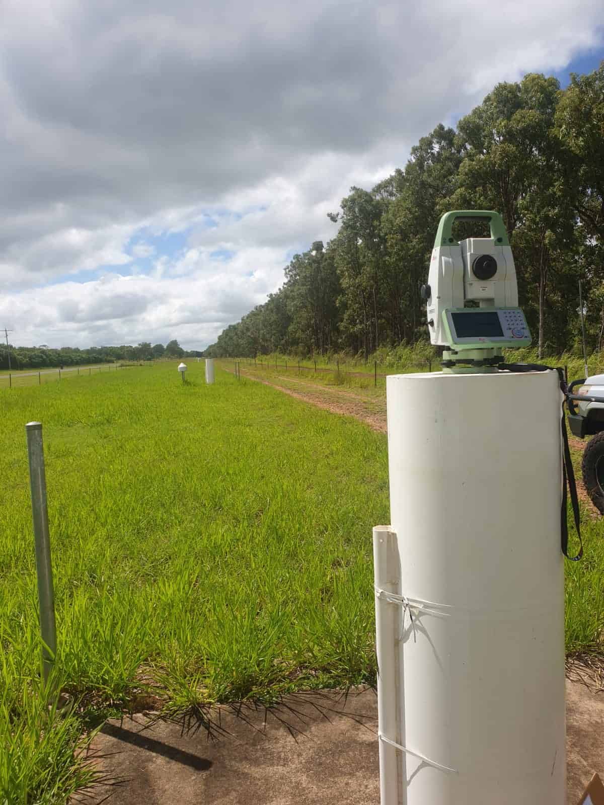
- Advanced Technology: Harnessing the latest technical surveying equipment to ensure data accuracy and reliability.
- Full Compliance: Adherence to Queensland’s legislation, standards and all relevant survey guidelines.
- Fully Insured: We carry all the appropriate insurances for performing surveys, including public liability and professional indemnity insurance.
- Preferred Supplier: Registered as a preferred supplier to federal, state and local governments, and a trusted surveyor for hundreds of clients achieving their survey goals.
- Wide Coverage: Serving Cairns, Mareeba and Atherton Tablelands, Cassowary Coast, Douglas Shire, and Cape York. We are happy to travel wherever the survey is.
For reliable, professional cadastral surveying in your area, call TerraModus Surveying on (07) 4054 4072 or complete our enquiry form. Let us provide the precise data you need to support your property needs confidently.
Frequently Asked Questions
What is a cadastral survey?
A cadastral survey is a land survey that defines the legal boundaries of a property. It establishes boundary lines, identifies easements and other interests such as leases, and determines the dimensions of land parcels.
Cadastral surveys are often used for property sales, development, subdivisions, and legal documentation of land ownership. These surveys are conducted by registered cadastral surveyors, who follow strict standards to ensure compliance with legislation, regulations and standards. Boundary identification surveys marks property boundaries accurately and provide an official plan confirming these marks - helping landowners avoid disputes and confidently plan for property improvements, construction, or future land transactions.
When is a cadastral survey required?
Cadastral surveys are essential in various situations, including property sales, subdivisions, developments near boundaries, and boundary disputes. They’re also used when building near property edges to ensure construction remains within legal limits. A cadastral survey may be required by local councils, legal bodies, or mortgage lenders to verify property boundaries before approving land transactions or development projects. By accurately defining boundaries and providing an official survey plan, cadastral surveys help property owners meet compliance requirements, ensure legal ownership, and prevent potential conflicts with neighbouring landowners.
What is a boundary identification survey?
A boundary identification survey confirms the exact boundary lines of a property, often by placing survey markers at each corner. It’s useful when installing fences, building structures, or verifying property limits. This survey is conducted by a registered cadastral surveyor and results in an official survey plan that serves as a legal reference. By marking boundaries accurately, it prevents encroachments and helps maintain good relations with neighbours.
Many councils or lenders may require this survey for developments, ensuring that property boundaries are legally confirmed before any significant improvements or construction projects begin.
What types of cadastral surveys do you perform?
TerraModus Surveying are experts in cadastral surveys. We perform all types of cadastral surveys including boundary identification, boundary realignment, subdivisions, amalgamation surveys, leases of land, easements, covenants, building format subdivisions (strata titling), volumetric surveys, road opening and road closure surveys and freeholding surveys. These surveys are performed in accordance with the Queensland Cadastral Survey Requirements and associated guidelines.
We also perform building lease surveys and prepare certified sketches to accompany the lease documentation. The building lease surveys involve locating the building on the property and measuring the internal dimensions of the tenancies in accordance with the Property Council of Australia’s Gross Lettable Area Retail measurements guidelines.