Expert Surveying Services in the Atherton Tablelands and Beyond
About Our Services
TerraModus Surveying provides reliable, valuable land surveying services designed for a range of needs. Serving the Atherton Tablelands, we specialise in cadastral and engineering surveys, covering everything from boundary identification and subdivisions to detailed site mapping. “TerraModus” means “earth measurement,” reflecting our commitment to delivering complete, accurate, high-quality measurement data for every project, regardless of complexity.
Our team works closely with developers, homeowners, government, and local businesses to provide accurate, comprehensive information for planning, development and property management. Whether it’s boundary setting, property development, obtaining topographic features, agricultural set-out, or navigating complex projects, TerraModus Surveying is here to support your goals with confidence.
If you’re looking for a dependable surveyor in the Atherton Tablelands, please complete our
enquiry form to discuss your project and receive guidance from a dedicated team.
What We Do
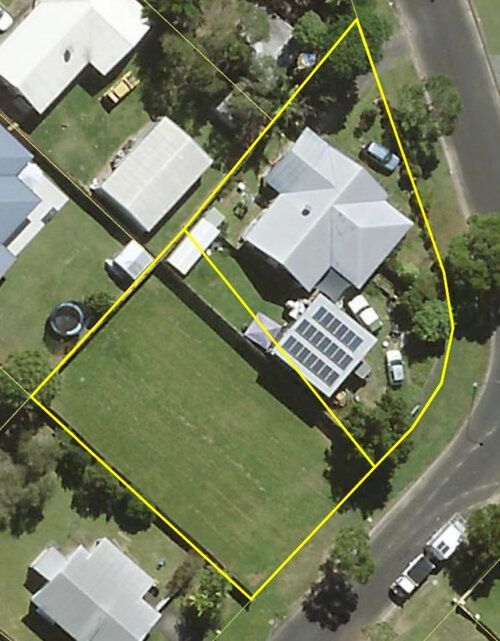
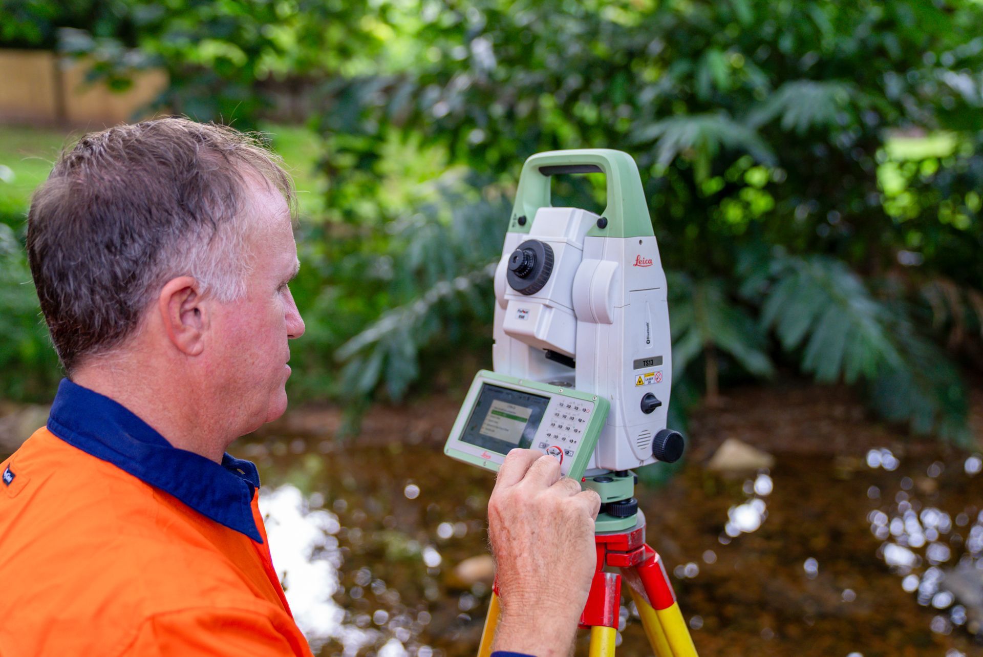
We offer cadastral surveys across the Atherton Tablelands, defining boundaries, easements, leases and subdivisions with accuracy. From residential plots to larger rural sites, our land measurements support property development, boundary realignments, construction and compliance with Queensland regulations. Our survey plans are produced and certified to the highest standards, supporting timely endorsement with the council and prompt registration with Titles Queensland. We provide the accuracy and certainty of cadastral boundaries you are looking for.
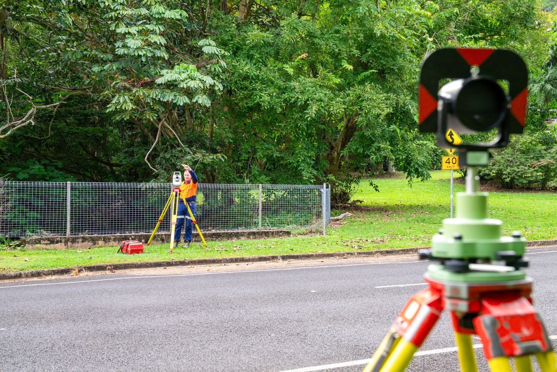
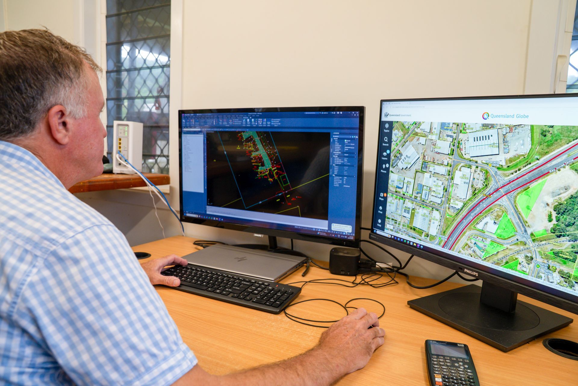
Our engineering surveys in the Atherton Tablelands provide critical data for construction and planning. We conduct topographic surveys, contour mapping, AHD heights, and as-constructed surveys. Our Computer Aided Design (CAD) files are unsurpassed in both detail and quality, delivering meticulous and dependable survey information to aid in project planning, design and construction. We provide the precise data driven survey solutions you require.
Why Choose Us?
Choose TerraModus Surveying for accuracy, dependability, and a client-focused approach to all your surveying needs. As a family-owned business, we’re dedicated to providing quality service with a personal touch, making us the preferred choice for the Atherton Tablelands. Here’s what sets us apart:
- Our team of registered surveyors brings extensive local knowledge to every project (Eddy is from the Tablelands)
- We offer full-service cadastral and engineering surveys tailored to meet diverse requirements.
- Field work is undertaken by registered cadastral and engineering surveyors ensuring proficient and reliable surveys on the ground, the first time
- You will receive precise, clear and certified survey data and files
- TerraModus Surveying provide quality, reliable plans ensuring your project meets all the building and council requirements
- Our superior quality assurance procedures ensure smooth endorsement with council and no delays for registration of survey plans
- Our friendly, professional support is responsive to each project’s unique needs.
- Complete surveying solutions for any project size, ensuring dedicated and valuable outcomes.
For a trusted surveyor in the Atherton Tablelands, call TerraModus Surveying on (07) 4054 4072. Let us provide the reliable data you need for every surveying requirement.
Enquire Now In Atherton Tablelands
* Please complete all fields of the form. As each survey is unique, we require the location of your survey to respond appropriately to your enquiry. If you have multiple attachments, please email us separately.
Contact Us
T. 07 4054 4072
M. 0413 580 146
Trading Hours
- Monday
- -
- Tuesday
- -
- Wednesday
- -
- Thursday
- -
- Friday
- -
- Saturday
- Appointment Only
- Sunday
- Appointment Only


Frequently Asked Questions
What areas do you service?
TerraModus Surveying provides a wide range of surveying services for the Atherton Tablelands and the surrounding areas, including Mareeba, Atherton, Kuranda, Speewah, Malanda, Dimbulah, Ravensoe, and all localities in the Mareeba and Atherton Shires. We also service further west including Etheridge Shire (Georgetown, Forsayth, Einasleigh and Mount Surprise areas), Croydon, Normanton, Karumba as well as Kowanyama.
Can cadastral surveys resolve boundary disputes?
Yes, cadastral surveys are often used to resolve disputes over land boundaries. By accurately establishing property lines, cadastral surveys clarify where one property ends, and another begins, helping to settle disagreements with neighbours. In cases of encroachments or unclear boundaries, a cadastral survey provides legally recognised evidence of property dimensions and boundaries. A registered cadastral surveyor can also offer advice on dealing with boundary encroachments according to local regulations. The resulting survey plan serves as official documentation that can be presented in legal settings if disputes escalate.
What is an engineering survey?
An engineering survey provides essential data on land contours, elevations, and features for use in construction, planning, and design. This type of survey includes contour and detail mapping, level assessments, and site measurements. Engineering surveys assist architects, engineers, and builders in understanding the land’s characteristics, ensuring projects are designed with site-specific data. These surveys can involve using various technologies, such as GNSS systems, for precise measurements. The data collected helps prevent construction issues and ensures that structures are built accurately and safely according to the unique conditions of each site.
What are the common types of engineering surveys?
Engineering surveys include several types, each serving unique project needs. Contour and detail surveys map the land’s elevation and features, aiding in site design. AHD level surveys provide height data relative to flood levels, while as-constructed surveys confirm that completed projects match approved plans. Monitoring surveys detect land or structure movement, ensuring stability over time. Control surveys establish reference points for accurate positioning on large projects. Each survey type contributes essential data, helping design, construction, and planning teams create structures aligned with local topography and regulatory requirements.
When is a cadastral survey required?
Cadastral surveys are essential in various situations, including subdivisions, developments near boundaries, and resolving boundary disputes. They are used when building near property boundaries to ensure construction remains within the approved and legal limits. A cadastral survey may be required by local councils, legal bodies, or mortgage lenders to verify property boundaries before approving land transactions or development projects. By accurately defining boundaries and providing an official survey plan, cadastral surveys help property owners meet compliance requirements, ensure legal ownership, and prevent potential conflicts with neighbouring landowners.
What is a contour and detail survey?
A contour and detail survey maps the land’s surface, showing elevation changes, natural features, and man-made structures. This type of survey is essential for design and construction projects, providing a detailed representation of the site’s characteristics. The data gathered helps architects, engineers, and builders understand the site’s layout, plan drainage systems, and design structures suited to the land’s contours. Using technologies like GNSS and total stations, surveyors create accurate maps that show elevation lines (contours) and detailed information about the land, improving the accuracy of construction and site preparation.