Expert Surveying Services in Cape York and Beyond
Our Trusted Services
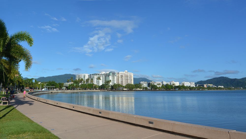
TerraModus Surveying offers professional, reliable and dependable land surveying services to meet a range of needs. Operating throughout Cape York and beyond, we specialise in cadastral and engineering surveys, including boundary identification, subdivisions, and detailed site mapping. We cover the entire Cook Shire area including Cooktown and Coen as well as the Weipa, Bamaga, the Torres Strait and the Gulf country (Normanton, Karumba, Kowanyama). “TerraModus” translates to “earth measurement,” highlighting our dedication to providing precise, high-quality data for every project, regardless of its complexity.
We work closely with developers, property owners, government, councils and local businesses to deliver accurate information essential for planning and land management. Whether it’s establishing boundaries, supporting property developments, or handling complex projects, TerraModus Surveying is here to help ensure your projects progress smoothly.
For a reliable surveyor in Cape York, please complete our enquiry form to discuss your project with our committed team.
What We Do
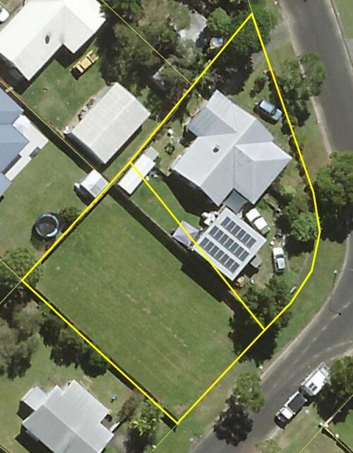
We conduct cadastral surveys across Cape York, Torres Strait and the Gulf to define property boundaries, easements, leases and subdivisions with accuracy. Our land measurement services aid in property development, boundary setting, and adherence to Queensland regulations. We provide the accuracy and certainty of property boundaries you are looking for.
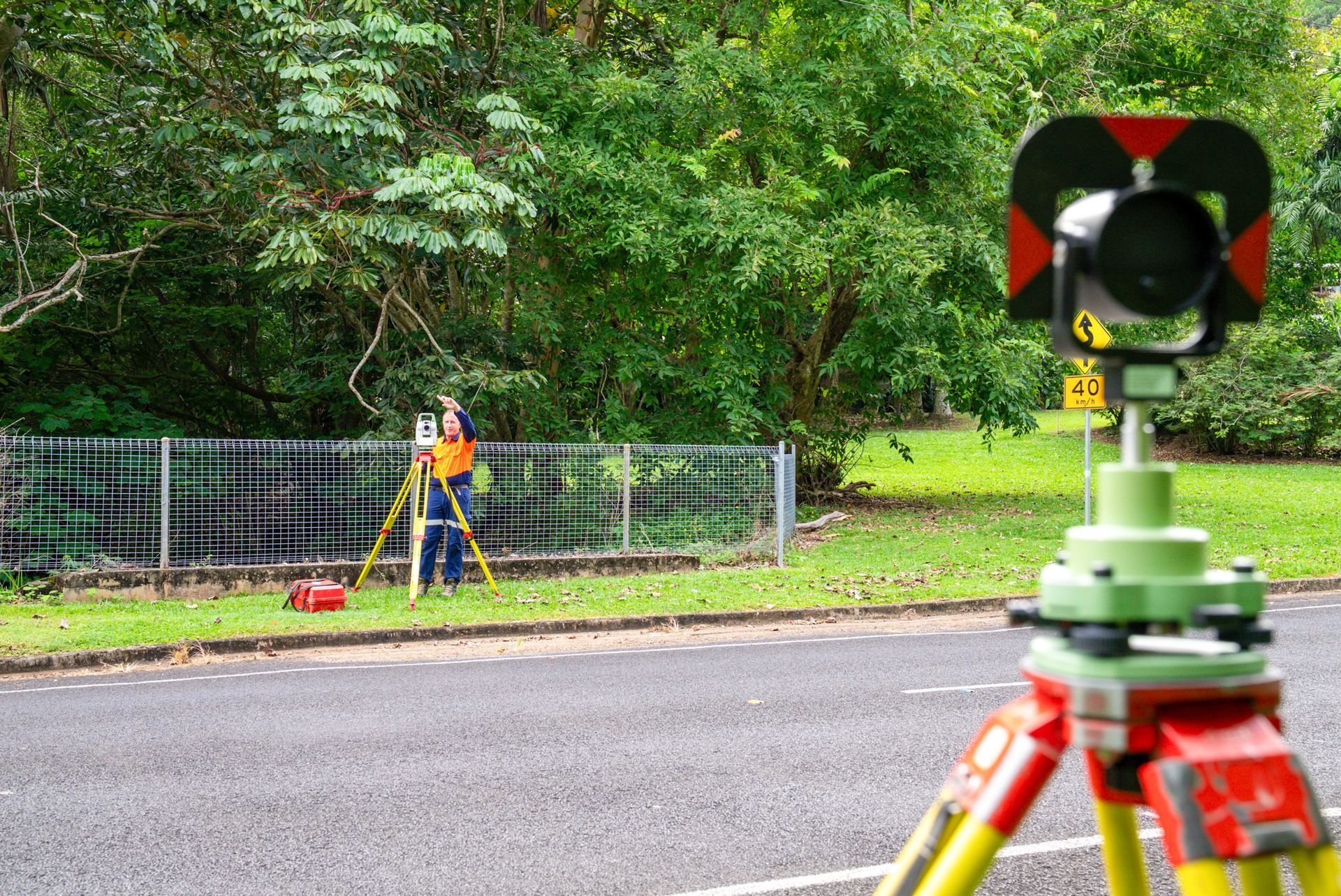
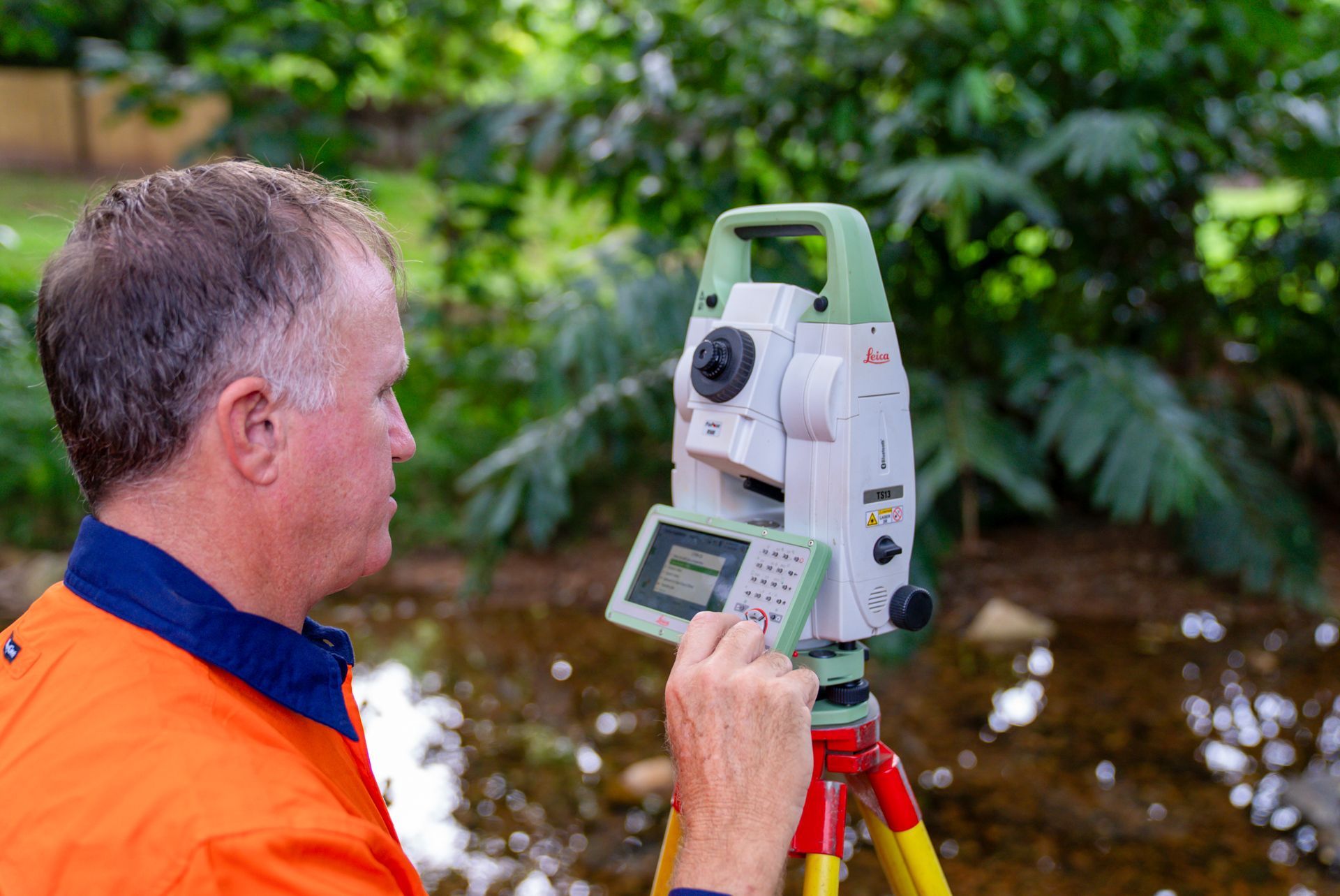
Our engineering surveys in Cape York provide vital information for construction and planning projects. Offering services such as contour mapping, detail surveys, AHD heights, and as-constructed surveys, we ensure reliable data to support project accuracy and compliance.
Why Choose Us?
Choose TerraModus Surveying for dependable accuracy and a client-first approach to all surveying needs. As a family-owned business, we are dedicated to delivering quality service, making us the trusted choice throughout Cape York, Torres Strait and the Gulf. Here’s what we bring to the table:
- Registered surveyors with extensive local knowledge on every project.
- Comprehensive cadastral and engineering surveys tailored to varied needs.
- Accurate, complete and reliable survey data for boundary identification, development, and regulatory compliance.
- Professional, friendly support customised to each project’s requirements.
- We are committed to the region – we live, work and holiday throughout FNQ.
- Dedicated, reliable survey solutions for projects of any size, ensuring value.
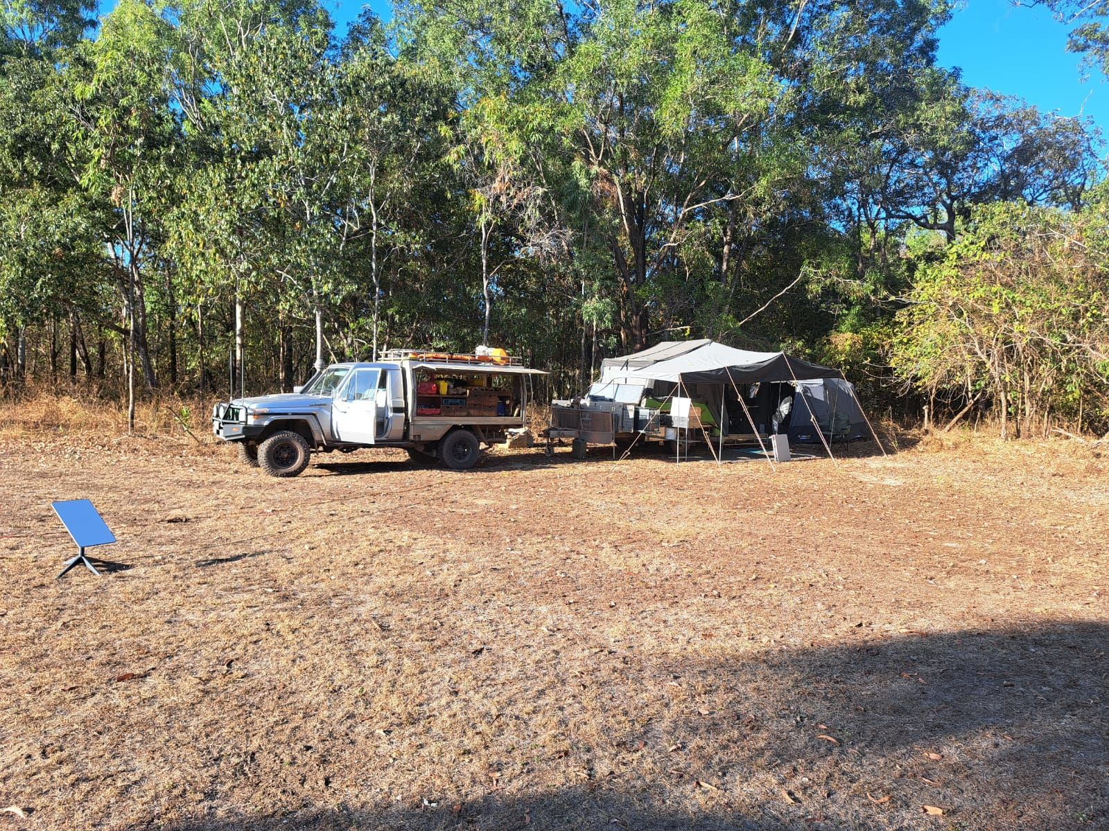
- Modern survey equipment, appropriately equipped 4WD vehicles and when needed, the ability to set-up a remote office.
For a trusted surveyor in Cape York, call TerraModus Surveying on (07) 4054 4072. Let us provide the reliable data you need for all surveying requirements.
Enquire Now In Cape York
* Please complete all fields of the form. As each survey is unique, we require the location of your survey to respond appropriately to your enquiry. If you have multiple attachments, please email us separately.
Contact Us
T. 07 4054 4072
M. 0413 580 146
Trading Hours
- Monday
- -
- Tuesday
- -
- Wednesday
- -
- Thursday
- -
- Friday
- -
- Saturday
- Appointment Only
- Sunday
- Appointment Only


Frequently Asked Questions
What areas do you service?
TerraModus Surveying provides a wide range of surveying services throughout Cape York and the surrounding areas, including Cooktown, Laura, Coen, Weipa, Bamaga and the Northern Peninsula Area.
What is a monitoring survey?
A monitoring survey tracks changes in land or structural movement over time. Used for sensitive or large-scale projects, these surveys detect shifts, ensuring stability and safety. Monitoring surveys are commonly conducted on structures like bridges, dams, or buildings, particularly in areas with potential for ground movement. By measuring horizontal and vertical movements at intervals, surveyors can identify any gradual shifts or damage. Regular monitoring helps engineers plan for maintenance or modifications, reducing risks associated with structural instability. This type of survey provides valuable data for assessing long-term safety and performance.
What is a control survey?
A control survey establishes a network of reference points on a construction site, providing accurate positioning data for subsequent surveys. These reference points, known as control points, serve as benchmarks for positioning structures, boundaries, or features consistently across a project. Control surveys are critical in large developments where high precision is needed for mapping, infrastructure and alignment. Engineers use these points to guide construction work, ensuring buildings, roads, and utilities are accurately placed. By creating a stable framework of coordinated marks, control surveys maintain consistency throughout the project’s duration, improving construction accuracy and efficiency.
What technology is used in engineering surveys?
Engineering surveys use advanced technologies, including GNSS (Global Navigation Satellite Systems), total stations, and laser scanning. GNSS offers high-precision positioning data, while total stations measure angles and distances with extreme accuracy, essential for complex mapping. Laser scanning captures 3D data quickly, creating detailed models of terrain and structures. Drones are also used to collect aerial data for large sites. Each technology provides surveyors with accurate, real-time data that supports detailed project planning. By using a combination of tools, engineering surveys gather comprehensive information that ensures construction precision, planning efficiency, and regulatory compliance.
What is a freeholding survey?
When a parcel of state or crown land is to be freeholded, it is required to be fully surveyed. Most state land parcels have not previously been surveyed and therefore a cadastral survey is required, and a new survey plan needs to be prepared for the issue of the deed of grant. As part of the survey requirements, there are often road openings and/or closures as well as the survey of water boundaries. TerraModus Surveying are experienced and proficient in supporting freeholding applications. We work with our client and step them through the requirements.